Meridian’s Ultimate Guide To GIS Mapping For Beginners
From pipelines to subdivisions and everything in between, GIS mapping turns raw data into actionable decisions. But what exactly is GIS? Geographic Information Systems (GIS) is a modern technology that captures, stores, analyzes, and visualizes spatial data, enabling surveyors, developers, and planners to make informed decisions. Meridian Surveys has decades of experience in GIS and […]
The Truth About Legal Surveys That Made Western Canada
The history of surveying is rich with innovative and inspiring people. These people laid the groundwork for determining every field, fence, and city lot in Western Canada to this day. You might think that a survey is just a map, but legal surveys are so much more. They are precise measurements that establish boundaries and […]
A Quick Guide To Routine Utility Surveys For Aging Infrastructure

It’s no surprise that aging infrastructure can be a problem for utility upgrades. Electrical lines, telecom cables, water, and gas are not always well mapped and buried deep underground. If you’re planning to dig or do any work underground, it’s critical to start with a utility survey before installations to understand what you’re working with. […]
Subdivision Surveys Insider: Helpful Facts That Get Permits Approved

When you’re taking on a project like splitting up farmland, creating a new residential neighbourhood, or adding lots to a rural property, a subdivision survey will be the first step to getting everything done right. A subdivision survey is a detailed process of dividing a large land parcel into smaller lots. This service is crucial […]
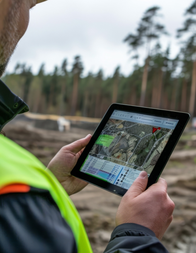
How GIS Mapping Tech Helps Unlock Civil Ordinance Insights
In recent years, a significant challenge for cities and municipalities has been transitioning from paper records to digital formats. Decades’ worth of municipal records, property maps, and land surveys often existed solely in physical form, making access and updates difficult. Digitizing this information is no small task for organizations, requiring precision, methodology, and expertise in Geographic […]
Surprising Ways Digital Mapping Can Transform Your Construction Surveying
For real estate developers, construction surveying is a non-negotiable step in project planning and completion. It provides the critical foundation of accurate measurements and data needed for all future decisions in the development process. However, your project is only as good as your survey and corresponding data— which is why you should trust Meridian Surveys for your construction […]
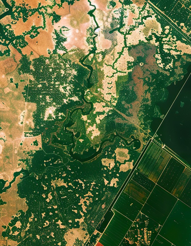
Ways GIS Mapping Is Proven to Help Environmental Conservation
While the benefits of GIS (Geographic Information Systems) mapping services are well-known in industries like residential and commercial surveying, their role in environmental conservation efforts is often overlooked. GIS technology helps conservation and wildlife management professionals better understand landscapes, track resources, and make informed decisions. When it comes to environmental conservation, GIS mapping offers essential tools for […]
What You Should Know Before Contacting Land Surveyors

When you’re embarking on a new land project, whether it’s developing real estate, expanding infrastructure, planning a pipeline, or even just moving your residential fence line, understanding the type of land survey you need is crucial. Land surveyors like Meridian Surveys often offer various survey types for residential and commercial clients, each tailored to specific needs and […]
Comparing GIS and Traditional Mapping Methods: Which is Right for Your Project?
When planning a new project that requires land surveying, one of the key decisions you’ll have to make is choosing between Geographic Information Systems (GIS) and traditional surveying methods. Both have their merits, but understanding the differences between the tried and true methods versus their modern counterparts can help you make the best choice for […]
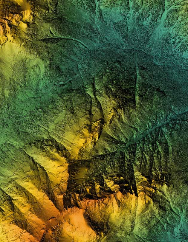
The Innovative Technologies Shaping the Future of Pipeline Surveys

The landscape of pipeline surveying is undergoing a significant transformation driven by innovative and emerging technologies. As the demand for more efficient, accurate, and environmentally conscious surveying methods grows, the industry continues to rapidly move away from traditional techniques and into a new era of sustainable, safe pipeline surveying. This shift is not only enhancing […]